Which is the best iPhone 3G application? a question I have asked it to my self and thus I have tested many which you can find in Apple Store or on Cydia (jailbreak iPhone application).
Being in Lebanon, there are no directions yet all we have is a detailed Beirut map and just main roads for the other cities (fair for now),
I was amazed by the iPhone build in GPS it is accurate to a nearly 2 to 5 meters when in open sky, and i had the opportunity to test it yesterday when it was so cloudy and it was working great as well.
I am testing and loving 3 applications using the GPS:
 Google Maps |  xGPS |  iMapmyhike |
- Maps: Maps is the built in GPS application provided by Google. This application is a great application but as we are in Lebanon there is nothing much to expect from it except having fun seeing yourself running across streets,and find me, you cannot use the Get Directions option, you cannot save your map, you cannot upload a map and most two things I don't like about is that it requires internet connection and it don't support cache. Sure in Lebanon we still don't have neither Edge or 3G we are counting on the GPRS which is rather expensive, so i looked for another application which don't require internet and i found:
- xGPRS: xGPRS is a great application that only Jailbreak iPhone can download it using Cydia (This is the case in Lebanon). What i like about this application:
- You can use it while offline: There are two ways to do this, first is to browse the map using search on your iPhone and use several zooming options for the areas you want to visit, the data will be saved on your iPhone to be used later offline, or you can use the PC software by which you can download several areas with several zooming capabilities making it so fun.Read more and download here.
- I like the arrow showing your direction as you are not shown as a lit circle, and the option that the map rotates, so you will not be going forward but shown on the map going downward(south).
- Turn by Turn navigation and sound assistance which is coming later to this software where you can upload your own root. This is awesome.
- IT IS FREE. It is a Must Have Application Thank you xGPS Team for your great work.
To download xGPS on your iPhone: Search for xGPS in Cydia and download it it is around 4.6 MB and there are reports of fail installation from the first time keep on trying where you have good connection to the network. - iMapmyhike:a wonderful free application provided by Apple Store, what are the good things about this application?
- This application is capable of recording your rout and then save it to your account at mapmyhike.com
- Sound assistance on the number of Km/Miles covered and the time period as you go.
- screen lock option to save power while on the go
- Lots of useful info that can be accessed easily while doing your favorite outdoor sport.
- The best thing I like it is that after saving your rout map over the internet you can upload it directly to your blog, Save as GPX, Save for Garmen, Save for Google earth. and sure sharing your map with all your friends
Here are some images I have taken on some Tour in Lebanon:
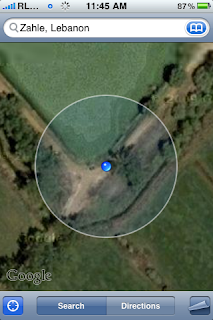 |  |  | |
| Taanayel Lake Bekaa. | Khaldeh Naamieh Highway | Zahle: Wadi el Arayish | Dmit River: Critical Gps situation |
 |  | | . |
iMapmyhike: Click on the map to see a recorded rout by car not hiking :) from my home in Hazmieh to Dora then to my work in Ashrafieh.
|  |
No comments:
Post a Comment